Caven Point/Pacific Avenues
Name:
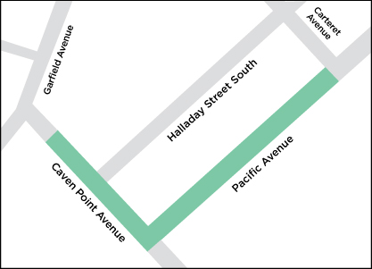
Caven Point/Pacific Avenues
Address:
Caven Point between Pacific and approximately 90 feet east of Garfield, and Pacific between Caven Point and Carteret.
NJDEP ID No.
G000005480
GROUNDWATER
January 2022: Groundwater Remedial Action Work Plan Garfield Avenue Group Sites
Appendices
Appendix A-1: Relevant Submittals: Groundwater Remedial Investigation Report, Final
Appendix A-2: Relevant Submittals: Responses to Comments on Definition of Low Permeability
Appendix B: Permit-By-Rule Requests and Authorizations – Phase I, Phase II, and Phase III IRMs
Appendix C: Geotechnical Evaluation of Active Remedies at Hudson County Chromate Site 199
Appendix D: Field Sampling Plan/Quality Assurance Project Plan and Field Change Notifications for the Groundwater Interim Remedial Measures
Regulatory Forms
Case Inventory Document
Cover Certification Form
Public Notification Form
SOIL
January 2024: Consent Judgment Compliance Letter for Soil
February 2022: Remedial Action Report Caven Point Avenue and Pacific Avenue Roadways
Appendices
Appendix A: Historical Water Table Elevations
Appendix B: Technical Memorandum: Caven Point Avenue and Pacific Avenue Roadways Compliance Averaging for Hexavalent Chromium in Soil
Appendix C: Notice in Lieu of Deed Notice
Appendix D: Technical Memorandum: Caven Point Avenue and Pacific Avenue Roadways Compliance Averaging for Antimony in Soil
Appendix E-1: Laboratory Analytical Reports
Appendix E-2: Documentation of EDD Submittal
Appendix F: Data Validation Reports
Appendix G: Boring Logs
September 2020: Remedial Investigation Report/Remedial Action Work Plan (Soil) – Caven Point Avenue and Pacific Avenue Roadways (AOC CPA-1A)
Tables
Table 3-1: Hexavalent Chromium Analytical Results Compared to Chromium Soil Cleanup Criterion
Table 3-2: CCPW Metals Analytical Results Compared to Soil Remediation Standards
Table 3-3: CCPW Metals Analytical Results in the Unsaturated Soil Zone Compared to IGW Soil Screening Level and Soil Remediation Standards
Table 5-1: Soil Remediation Standards/Criteria
Figures
Figure 1-1: USGS Site Location Map
Figure 1-2: Garfield Avenue Group Site Plan
Figure 2-1: Caven Point Avenue and Pacific Avenue Roadways Site Plan
Figure 3-1: Investigation Locations and Site Impacts – Hexavalent Chromium and Antimony
Figure 6-1: Area Subject to Monitoring for Chromium Blooming and Chromium Staining
Appendices
Appendix A: Historical Water Table Elevations
Appendix B: Field Records
Appendix C: Laboratory Analytical Reports and Data Validation Reports
Appendix D: Draft Notice in Lieu of Deed Notice
September 2018: Remedial Action Work Plan
Tables
Table 1-1: Achievement of NJDEP Conditions for Approval
Table 1-2: Non-Residential Chrome Chemical Production Waste Site Property Owners
Table 3-1: Compounds Exceeding Regulatory Criteria On or Emanating from Site 114
Table 3-2: Remedial Standards for Soil
Table 5-1: Sample Summary
Figures and Drawings
Figure 1-1: USGS Site Location Map (1981)
Figure 1-1A: Site Map
Drawing 1-2: 2011 Existing Conditions Plan (Phases 1 & 2)
Drawing 1-3: 2011 Existing Conditions Plan (Phase 3)
Drawing 1-4: Cross Section A-A’
Drawing 1-5: Cross Section B-B’
Drawing 1-6: Cross Section C-C’
Drawing 1-7: Cross Section D-D’
Drawing 1-8: Cross Section E-E’
Drawing 1-9: Cross Section F-F’
Drawing 1-10: Cross Section G-G’
Drawing 1-11: Cross Section H-H’
Drawing 1-12: Cross Section I-I’
Drawing 1-13: Cross Section J-J’
Drawing 1-14: Cross Section K-K’
Drawing 1-15: Cross Section L-L’
Drawing 1-16: Cross Section M-M’
Drawing 6-1: Conceptual Phase 1 Site Preparation and Erosion Control
Drawing 6-2: Conceptual Phase 2 Site Preparation and Erosion Control
Drawing 6-3: Conceptual Phase 3 Site Preparation and Erosion Control
Drawing 6-4: Conceptual Site Preparation and Erosion Control Details
Drawing 6-5: Conceptual Phase 1 Excavation Plan
Drawing 6-6: Conceptual Phase 1 Excavation Plan (Northern Excavation)
Drawing 6-7: Conceptual Phase 2 Excavation Plan
Drawing 6-8: Conceptual Phase 3 Excavation Plan
Drawing 6-9: Conceptual Sheet Pile Details
Drawing 7-1: IRM Final Grading and Water Treatment System Secondary Containment
Drawing 7-2: Water Treatment System Modutank Secondary Containment
Drawing 7-3: Typical Dewatering Plan
Drawing 8-1: Extent of Free-Phase MGP Contamination
Drawing 11-1: Stormwater Restoration and Final Grading Plan
Drawing 11-2: Restoration Details
Drawing 17-1: Garfield Avenue Group Remedial Progress Plan
Drawing 17-2: Garfield Avenue Group Remedial Progress Plan
Drawing 17-3: Garfield Avenue Group Remedial Progress Plan
Drawing 17-4: Garfield Avenue Group Remedial Progress Plan
Drawing 17-5: Garfield Avenue Group Remedial Progress Plan
Drawing 17-6: Garfield Avenue Group Remedial Progress Plan
Drawing 17-7: Garfield Avenue Group Remedial Progress Plan
Drawing 17-8: Garfield Avenue Group Remedial Progress Plan
Drawing 17-9: Garfield Avenue Group Remedial Progress Plan
Drawing 17-10: Garfield Avenue Group Remedial Progress Plan
Drawing 17-11: Master Schedule Summary
Drawing 17-12: Excavation Sequence
Appendices
Appendix A: Air Monitoring Plan (AMP)
Appendix B: Dust Control Plan (DCP)
Appendix C: Traffic Safety and Control Plan (TSCP)
Appendix D: Soil and Stockpile Management Plan (SSMP)
Appendix E: Health and Safety Plan (HASP)
Appendix F: Exhibit A – Excavation Plan
Appendix G: Example Draft Deed Notice
Appendix H: Receptor Evaluation
Appendix I: Level 3 Survey Performed by Enviroscan
Appendix J: Copy of Approved Permits
Appendix K: Contingency and Communications Plan
Appendix L: Capillary Break Design Report
August 2018: Supplemental Soil Remedial Investigation Report
Tables
Table 1-1: Summary of Investigation Locations
Table 4-1: Sample Investigation Details
Table 4-2: Soil Sample Summary
Table 4-3: Analytical Results - Synthetic Precipitation Leaching Procedure
Table 5-1: Analytical Results - Hexavalent Chromium and CCPW Metals Compared to SRS – Garfield Avenue Group
Table 5-2: Analytical Results - Hexavalent Chromium and CCPW Metals Compared to SRS – Northern Canal Area Site
Table 5-3: Analytical Results - Hexavalent Chromium and CCPW Metals Compared to IGW SSL/SRS – Garfield Avenue Group
Table 5-4: Analytical Results – SVOCs Compared to SRS – Garfield Avenue Group
Table 5-5: Analytical Results – SVOCs Compared IGW SSL – Garfield Avenue Group
Table 5-6: Analytical Results – VOCs Compared to SRS – Garfield Avenue Group
Table 5-7: Analytical Results – VOCs Compared to IGW SSL – Garfield Avenue Group
Table 5-8: Analytical Results – PCBs Compared to SRS – Garfield Avenue Group
Table 5-9: Analytical Results – PCBs Compared to IGW SSL – Garfield Avenue Group
Figures
Figure 1-1: USGS Site Location Map
Figure 1-2: Site Plan
Figure 2-1: Garfield Avenue Group Sites Interim Remedial Measures
Figure 4-1: Investigation Locations
Figure 5-1: CCPW Material Observed in Soil Borings – Northwest Garfield Avenue Sites
Figure 5-2: CCPW Material Observed in Soil Borings – Northeast Garfield Avenue Sites
Figure 5-3: CCPW Material Observed in Soil Borings – Southern Garfield Avenue Sites
Figure 5-4: CCPW Material Observed in Soil Borings – Northern Canal Area
Figure 5-5: Soil Comparison to NJDEP CrSCC - Northwest Garfield Avenue Sites, Hexavalent Chromium
Figure 5-6: Soil Comparison to NJDEP CrSCC - Northeast Garfield Avenue Sites, Hexavalent Chromium
Figure 5-7: Soil Comparison to NJDEP CrSCC - Southern Garfield Avenue Sites, Hexavalent Chromium
Figure 5-8: Soil Comparison to NJDEP CrSCC – Northern Canal Area, Hexavalent Chromium
Figure 5-9: Soil Comparison to NJDEP SRS - Northwest Garfield Avenue Sites, CCPW Metals
Figure 5-10: Soil Comparison to NJDEP SRS - Northeast Garfield Avenue Sites, CCPW Metals
Figure 5-11: Soil Comparison to NJDEP SRS - Southern Garfield Avenue Sites, CCPW Metals
Figure 5-12: Soil Comparison to NJDEP SRS – Northerm Canal Area, CCPW Metals
Figure 5-13: Soil Comparison to NJDEP IGW SRS/SSL - Northwest Garfield Avenue Sites, CCPW Metals
Figure 5-14: Soil Comparison to NJDEP IGW SRS/SSL - Northeast Garfield Avenue Sites, CCPW Metals
Figure 5-15: Soil Comparison to NJDEP IGW SRS/SSL - Southern Garfield Avenue Sites, CCPW Metals
Figure 5-16: Soil Comparison to NJDEP SRS – Northeast Garfield Avenue Sites, Group 1 SVOCs
Figure 5-17: Soil Comparison to NJDEP SRS – Northeast Garfield Avenue Sites, Group 2 SVOCs
Figure 5-18: Soil Comparison to NJDEP IGW SSL– Northeast Garfield Avenue Sites, SVOCs
Figure 5-19: Soil Comparison to NJDEP SRS - Northeast Garfield Avenue Sites, VOCs
Figure 5-20: Soil Comparison to NJDEP IGW SSL - Northeast Garfield Avenue Sites, VOCs
Figure 5-21: Soil Comparison to NJDEP SRS/IGW SSL - Garfield Avenue Sites, Total PCBs
Appendices
Appendix A: Remedial Investigation Report (RIR) - Soil, Garfield Avenue Group Non-Residential
Appendix B: FOR-005 Additional Forrest Street Remedial Investigation – Soil & Groundwater Technical Memorandum
Appendix C: Halsted Building Remedial Investigation Results – Soil Technical Memorandum
Appendix D: Northern Morris Canal Investigation – Berry Lane Park to Communipaw Avenue Technical Memorandum
Appendix E: Supplemental East-West Geologic Cross-Section
Appendix F: Synthetic Precipitation Leaching Procedure (SPLP) Calculations
Appendix G: Data Validation Reports
Appendix H: Laboratory Data Packages
Appendix I: Boring Logs
Appendix J: Historical Data Verification Technical Memorandum
Appendix K: PPG/Honeywell Site 199 Agreement
Miscellany
Cover/Certification Form
Case Inventory Document
Receptor Evaluation
ABOUT US
|
PROGRESS REPORTS
|
CLEANUP REPORTS
|
HEALTH & SAFETY
|
CONTACT
© 2009 - 2025 CHROMIUM CLEANUP PARTNERSHIP